


KING TWP Voting District, Winnebago County, Iowa
About
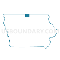
Outline

Summary
| Unique Area Identifier | 583728 |
| Name | KING TWP Voting District |
| County | Winnebago County |
| State | Iowa |
| Area (square miles) | 35.95 |
| Land Area (square miles) | 35.94 |
| Water Area (square miles) | 0.01 |
| % of Land Area | 99.97 |
| % of Water Area | 0.03 |
| Latitude of the Internal Point | 43.39228010 |
| Longtitude of the Internal Point | -93.78376940 |
Maps


Graphs
Select a template below for downloading or customizing gragh for KING TWP Voting District, Winnebago County, Iowa


Neighbors
Neighoring Voting District (by Name) Neighboring Voting District on the Map
- BUFFALO TWP Voting District, Winnebago County, IA
- EDEN TWP Voting District, Winnebago County, IA
- FOREST TWP PART W/O FOREST CITY & LELAND Voting District, Winnebago County, IA
- GRANT TWP Voting District, Winnebago County, IA
- LINCOLN TWP Voting District, Winnebago County, IA
- LINDEN TWP Voting District, Winnebago County, IA
- LOGAN TWP W/O SCARVILLE Voting District, Winnebago County, IA
- NEWTON TWP Voting District, Winnebago County, IA
Top 10 Neighboring County Subdivision (by Population) Neighboring County Subdivision on the Map
- Forest township, Winnebago County, IA (4,611)
- Buffalo township, Winnebago County, IA (1,106)
- King township, Winnebago County, IA (652)
- Lincoln township, Winnebago County, IA (355)
- Newton township, Winnebago County, IA (211)
- Logan township, Winnebago County, IA (201)
- Grant township, Winnebago County, IA (148)
- Linden township, Winnebago County, IA (133)
- Eden township, Winnebago County, IA (104)